
Eagle Rock and Curracurrong Falls — Royal National Park Coastal Walk Guide
The walk from Wattamolla Beach to Eagle Rock is one of the best coastal walks near Sydney — a 4km section of the Royal National Park's Coast Track that takes you along sandstone headlands above the Pacific Ocean to one of the park's most unusual natural features.
Most people come for Eagle Rock. The waterfall at the end of the walk is the better story.
Curracurrong Falls
Curracurrong Falls drops 82 metres off the edge of a sandstone cliff directly into the ocean below — one of only three waterfalls in Australia that plunge straight into the sea, and one of fewer than 50 in the world. On windy days the falls become a reverse waterfall, the water blown back up as mist against the cliff face before it can reach the waves.
It's the kind of place that doesn't quite look real when you first see it.
Eagle Rock
Eagle Rock is a large sandstone overhang at the cliff edge, a short distance north of Curracurrong Falls. What makes it unusual is that it looks completely different depending on which direction you approach from.
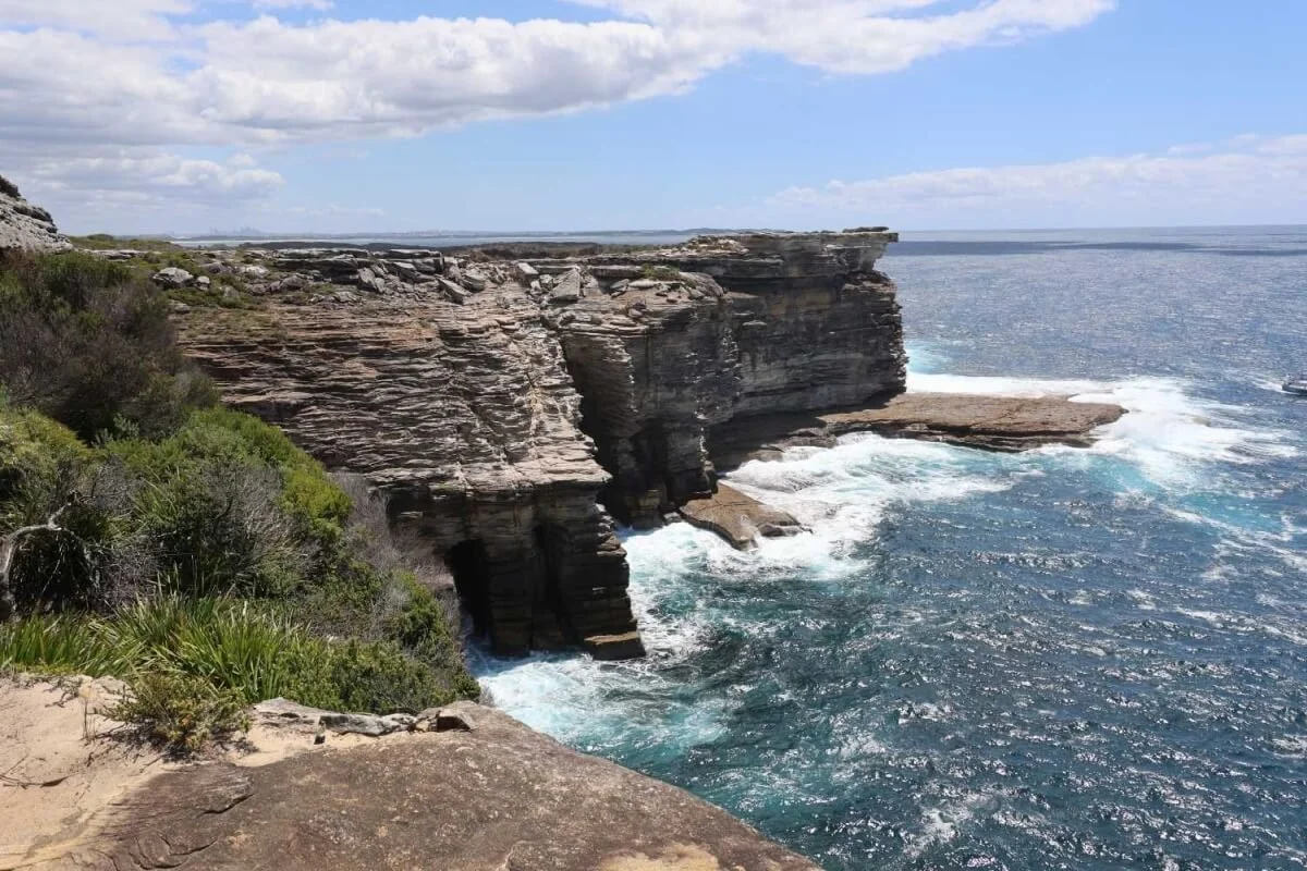
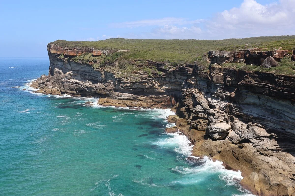
From the north, walking down from Wattamolla, you see a large rectangular block of sandstone protruding from the cliff — imposing but unremarkable. Cross Curracurrong Creek and look back from the south side of the bay and the rectangle disappears entirely. What you see instead is the unmistakable profile of an eagle's head — beak, eye, forehead — carved by weathering and erosion into the cliff face over millions of years.
Some visitors see a turtle's head. We're going with eagle.
The best view of Curracurrong Falls is actually from the top of Eagle Rock itself — cross the low heathland from the main boardwalk toward the cliff edge and the full scale of the falls becomes clear.
The Walk
The standard route is from Wattamolla Beach, walking south along the Coast Track to Eagle Rock and Curracurrong Falls and returning the same way.
Distance: 8km return
Duration: approximately 2.5 hours return at a comfortable pace
Grade: easy to moderate
Start: Wattamolla Beach carpark, off Wattamolla Drive, Royal National Park
The track is well-maintained with a coastal boardwalk for most of the route. The approach to Eagle Rock requires crossing Curracurrong Creek — straightforward in normal conditions but worth checking after heavy rain.
Alternative starting point — Garie Beach
The same destination can be reached from Garie Beach to the south, walking north along the Coast Track. This route is approximately 7.7km return and allows around 3 hours. The approach from Garie involves a steep climb up from the beach onto the headland before the track levels out.
Getting There
Wattamolla Beach is accessed via Wattamolla Drive off Sir Bertram Stevens Drive inside the Royal National Park. A national park entry fee applies.
The Wattamolla carpark fills quickly on sunny weekends and public holidays. The park closes the access road when the carpark is full. Arriving before 10am on busy days avoids this problem. The Royal National Park's social media accounts post updates when the road is closed.
What Else to Look For
The heathland between Wattamolla and Eagle Rock is worth taking slowly. Banksias, wildflowers and coastal scrub line the track, and the headland above Garie Beach to the south offers wide ocean views. The water below the cliffs near Eagle Rock is shallow enough to show the sandy bottom on clear days — an unusual turquoise-green colour in good light.
Lyrebirds are occasionally heard in the forested sections closer to Wattamolla.
Visiting with Sydney Nimble Tours
The Eagle Rock and Curracurrong Falls walk is one of the highlights of our Royal National Park private tour from Sydney. We handle transport and park entry — you focus on the walk.
Royal National Park Private Day Tour from Sydney >>>
Garie Beach — the starting point for the walk north to Eagle Rock
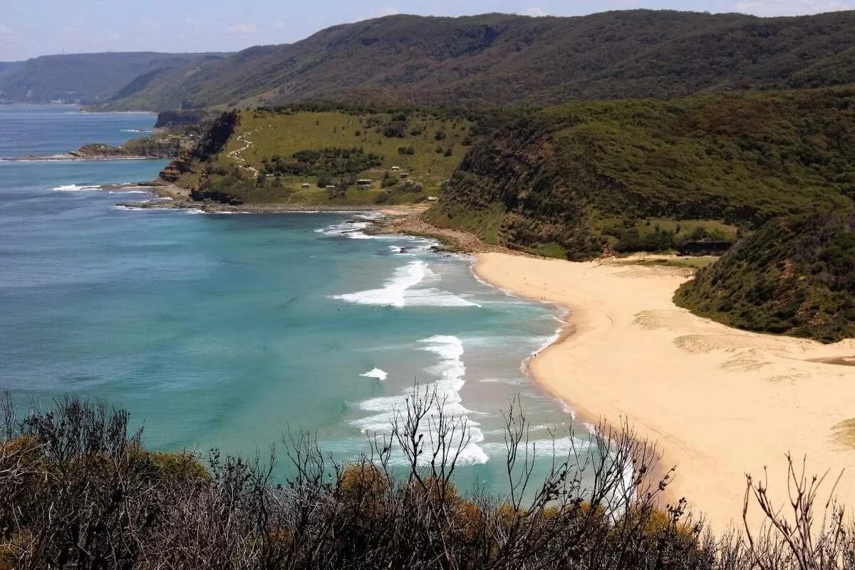
Garie Beach from the southern headland — the walk north to Eagle Rock begins at the far end of the beach
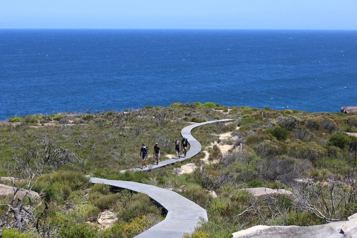
The boardwalk through coastal heathland on the approach to Eagle Rock Note
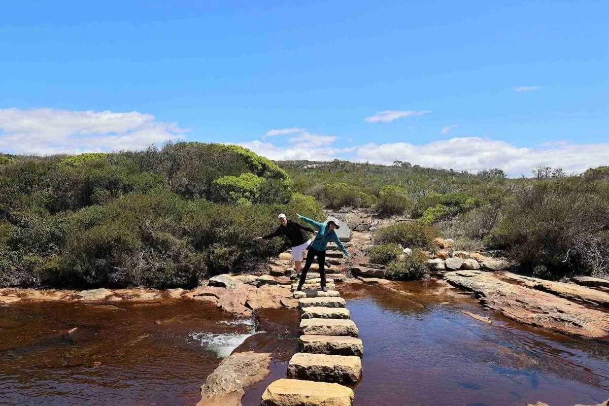
Crossing Curracurrong Creek on the way to Eagle Rock
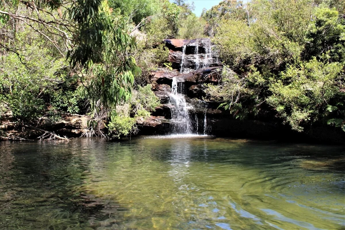
The Curracurrong swimming hole — a freshwater pool fed by a tiered waterfall, a natural rest stop on the walk
The Marley track headland — Sydney visible on the horizon to the north
Eagle Rock from the coastal track — from this angle the flat rectangular overhang is visible
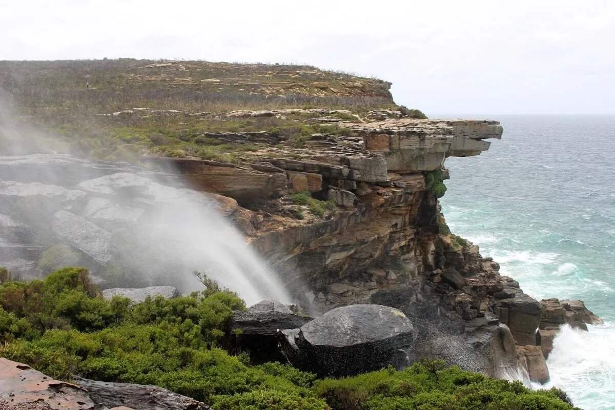
Curracurrong Falls on a windy day — the waterfall blown back up the cliff by the force of the wind, with Eagle Rock behind
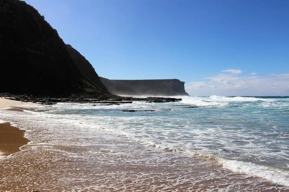
The bay at Curracurrong Creek — the water is clear enough to see the sandy bottom on a sunny day
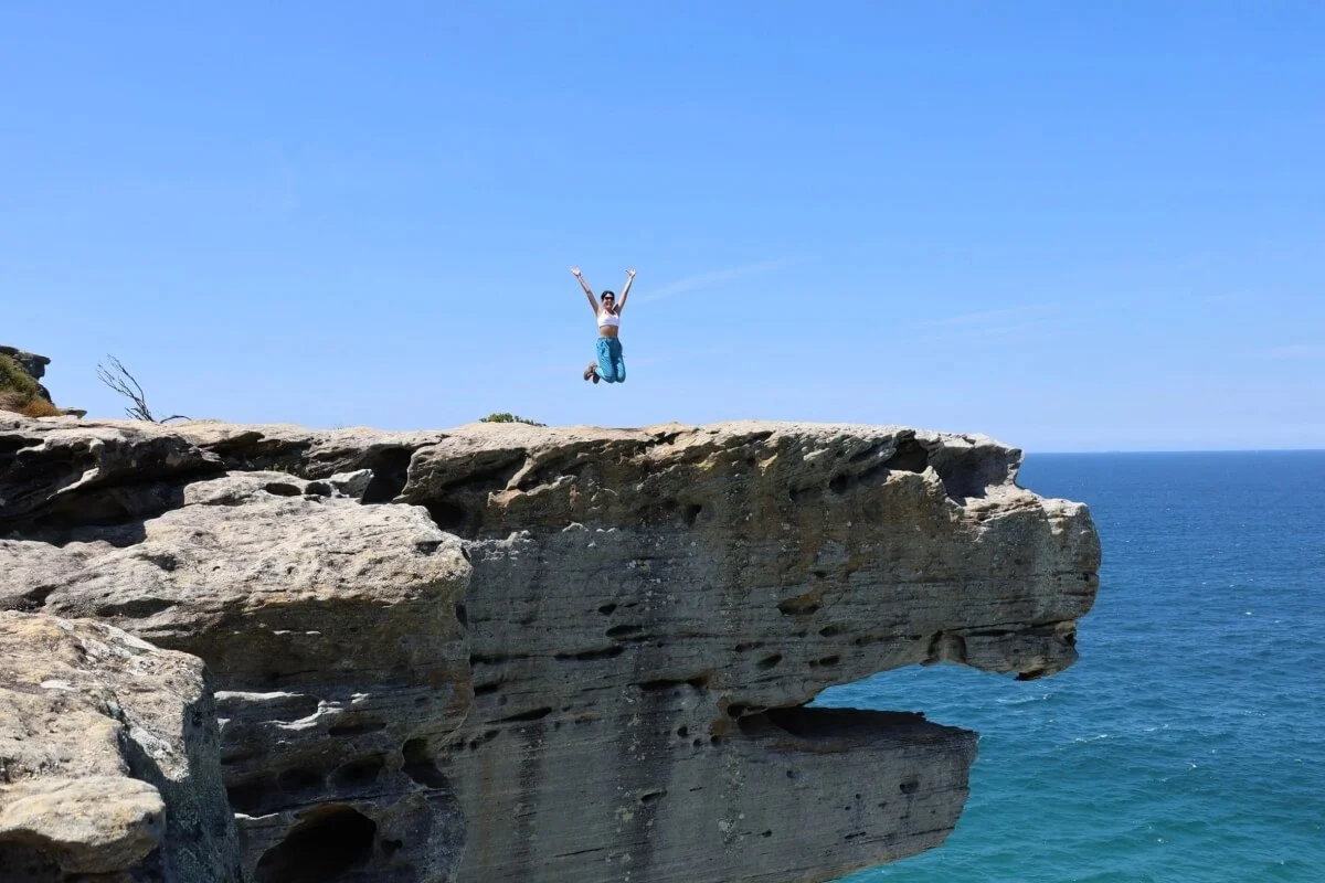
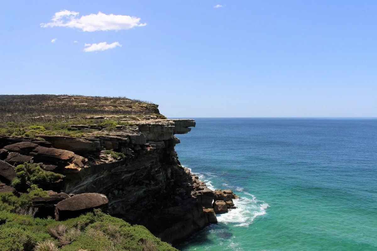
Eagle Rock from the top — the flat sandstone overhang above the Pacific
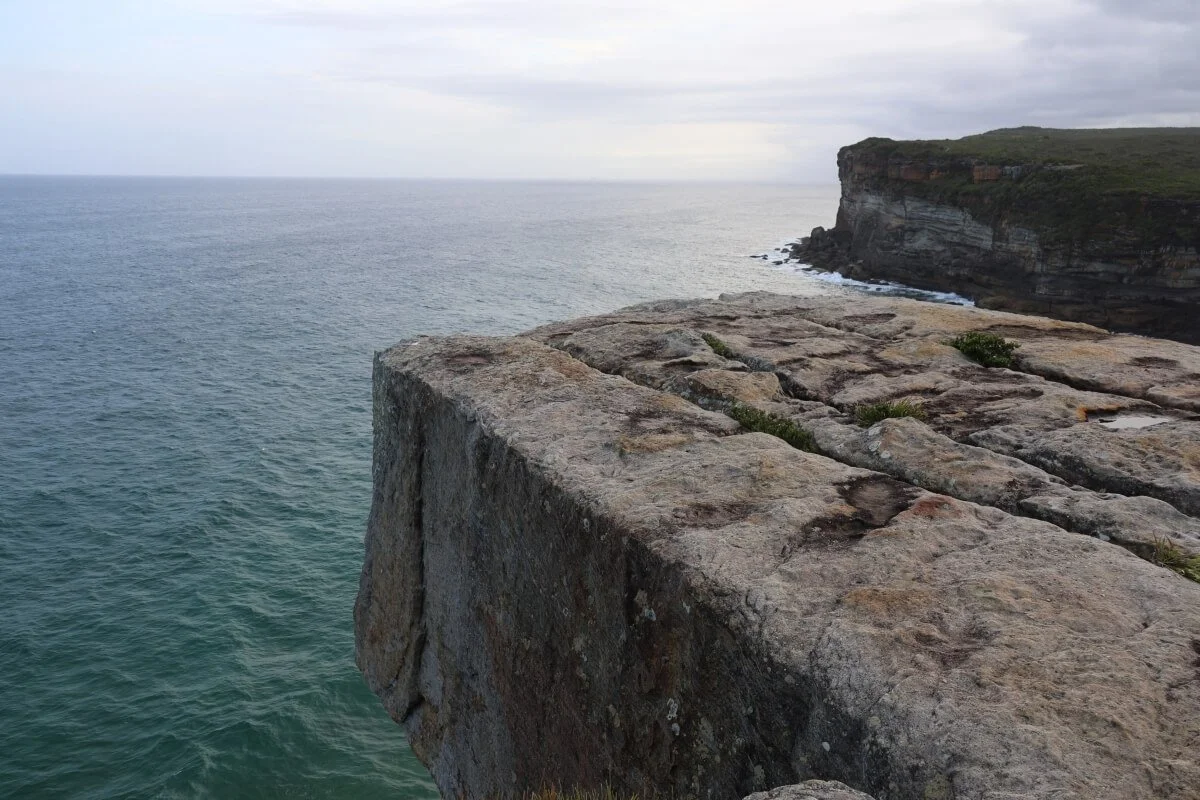
Eagle Rock from the top — the flat sandstone edge overhanging the ocean. Cross to the south side of the bay and the same rock becomes an eagle's head

Wattamolla — the lagoon, waterfall and beach at the northern end of the walk